High-Resolution from the Stratosphere
We are developing a new generation of high-altitude balloon technology for observations, supporting farmers' decision-making, and enhancing agricultural predictability.
Why Agroloon?
Agroloon aims to revolutionize agricultural forecasting by developing a new generation of high-altitude balloon technology. This innovation supports farmers' decision-making and enhances agricultural predictability by providing high-resolution images from the stratosphere.
Our system enables the detection of the smallest differences in fields on an hourly basis, leading to effective damage assessment and yield prediction. By providing unprecedented visibility into crop health and field conditions, we empower agricultural stakeholders to make data-driven decisions that optimize yield and reduce waste.
A stunning view of Lake Tisza with shimmering waters
Infrared imaging highlights water bodies distinctly

Visualizes NDVI to assess vegetation health

Shows distinct cloud formations clearly

Cloud maps refine NDVI and other data

False-color imagery enhances data contrast

GRVI compares green and red bands for vegetation health

A stunning view of Lake Tisza with shimmering waters
Infrared imaging highlights water bodies distinctly
Visualizes NDVI to assess vegetation health
Shows distinct cloud formations clearly
Cloud maps refine NDVI and other data
False-color imagery enhances data contrast
GRVI compares green and red bands for vegetation health

3 small villages north of Heves

NIR spectrum reveals the road network

Visualizes NDVI to assess vegetation health

Shows distinct cloud formations clearly

Cloud maps refine NDVI and other data

False-color imagery enhances data contrast

GRVI compares green and red bands for vegetation health
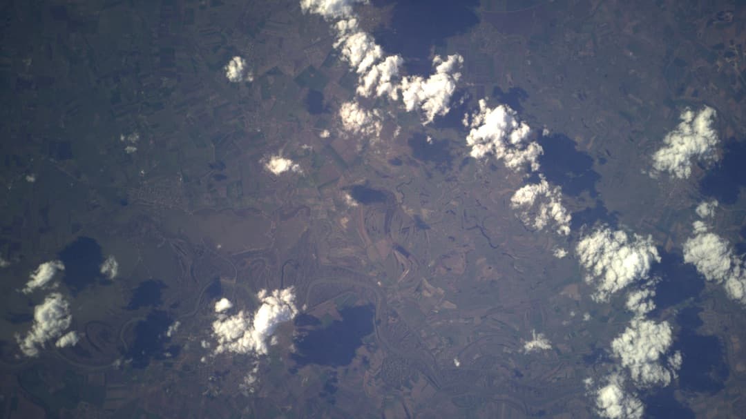
3 small villages north of Heves
NIR spectrum reveals the road network
Visualizes NDVI to assess vegetation health
Shows distinct cloud formations clearly
Cloud maps refine NDVI and other data
False-color imagery enhances data contrast
GRVI compares green and red bands for vegetation health
3 small villages north of Heves
NIR spectrum reveals the road network
Visualizes NDVI to assess vegetation health
Shows distinct cloud formations clearly
Cloud maps refine NDVI and other data
False-color imagery enhances data contrast
GRVI compares green and red bands for vegetation health
What We Offer
Agroloon offers a high-altitude balloon system capable of monitoring the state of agricultural fields. The system provides ultra-high-resolution images with a resolution of 5x5 cm, which is approximately 600% higher quality than average satellite images.
This allows for the detection of minor variations in fields on an hourly basis, facilitating effective damage assessment and yield prediction. Moreover, Agroloon's service is cost-effective, offering data at less than half the price of existing methods while delivering more accurate data 24/7.
600%
Higher quality than average satellite imagery
5×5 cm
Ultra-high precision per pixel
50%
Lower cost than existing monitoring methods
Ready to Transform Your Agricultural Insights?
Discover the power of precision agriculture. With Agroloon's advanced imaging solutions, gain insights that transform your farming operations and drive sustainable growth.